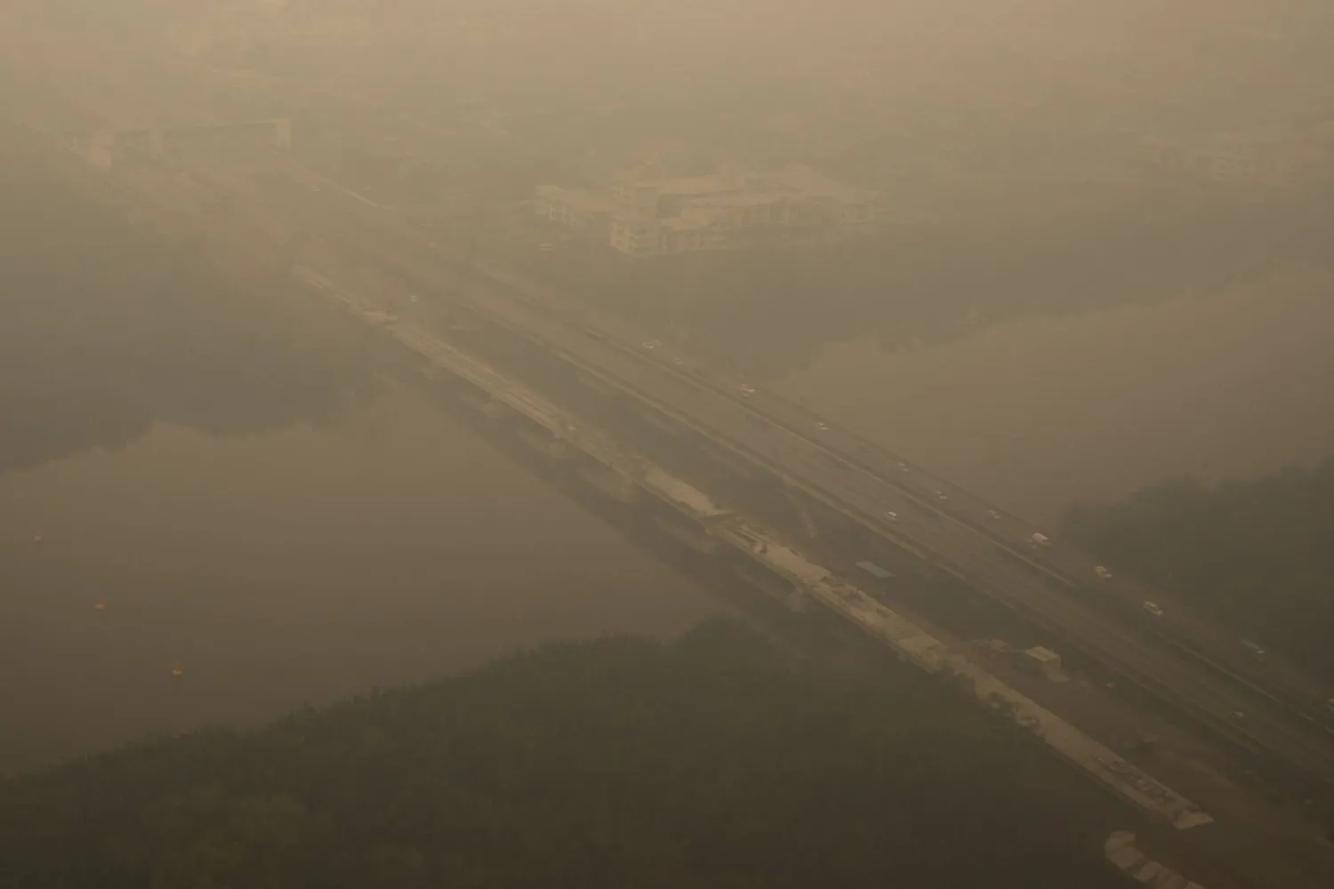
Wildfires are a growing problem in Indonesia, as carbon dioxide emissions from fires have become the world’s largest of all countries, as forests and peatlands burn in Borneo and Sumatra.

Between September 1 and 7, the monitoring portal, Fire Emissions Watch, set up by the European Union’s Copernicus climate service, reported that fire emissions in Indonesia were 19.7 million metric tons. Indonesia surpassed Russia in the week, with more than a third of the total global emissions from fires.
The fires are primarily in the Indonesian region of Borneo (Kalimantan) and eastern Sumatra. Copernicus data indicated fire emission intensity more than 1,500 kilograms per square kilometre, which is more than ten times the Russian level.
This week’s emissions were 273 percent higher than the average emissions of Indonesia during the season. The figures were still lower than last year however, when Indonesia faced similar severe El Niño weather in 2015, the figure was 21.7 million metric tons in the same week.
Indonesia is now facing its worst wildfire season in a decade, according to the authorities. The extreme heat and dryness associated with so-called “super-El Niño” has resulted in especially dry conditions, which can lead to more intense fires once they have begun.
The dry and hot conditions were greatly enhancing the fires, said Mark Parrington, senior scientist at the Copernicus Atmosphere Monitoring Service.
One of the worst hit is the city of Pontianak in West Kalimantan. It has an air quality index of 394 as of Wednesday, with an index of 300 or higher being considered hazardous, according to IQAir.
The air quality hazard reading in Kalimantan and other parts of the country is alarming to the environment ministry of the Republic of Indonesia. The ministry also said Copernicus fire-emission information doesn’t reflect what air quality is in a specific place because other factors have to be taken into account.
The area affected by fires has also increased. According to the environmental group YKAN, Nisa Novita, some 202,000 hectares of land in Indonesia have been on fire since January to July. She estimated that there might have been an additional 600,000 hectares in August, especially in Kalimantan, Sumatra and South Papua.
To give a rough idea of what this equates to, approximately 2.6 million hectares of Indonesia burned in 2015, which is similar to the size of Wales.
There was also a significant increase in the number of hotspots recorded. The number of hotspots detected by the Sipongi monitoring platform in Indonesia increased from 13,443 in the period 1st August-8th September 2016 to 9,454 in 2015. Satellite data from NASA’s Terra and Aqua satellites are used with this system.
The figures are still considered to be an underestimate of fire size, scientists warn. Some fires can be smoldering fires at low temperatures under the peatland and go unnoticed by satellites.
The fire crisis in Indonesia in 2015 resulted in vast quantities of pollution and has been associated in studies with over 100,000 additional deaths in Indonesia, Malaysia and Singapore.
The fire season is still at an early stage and emissions may continue to increase through October like they did in 2015, Parrington said. Initial signs are that this year’s fire activity is on track to match, or perhaps exceed, the previous high-El Niño years, he added.
Source: Reuters

Leave a Reply